We spent a lot of time debating what route we would take to get to Alaska. As I began dreaming, I ordered a Milepost and read that thing cover.to.cover. I started marking things I wanted to do/see in Canada and then backtracked to how we would actually get TO Canada.
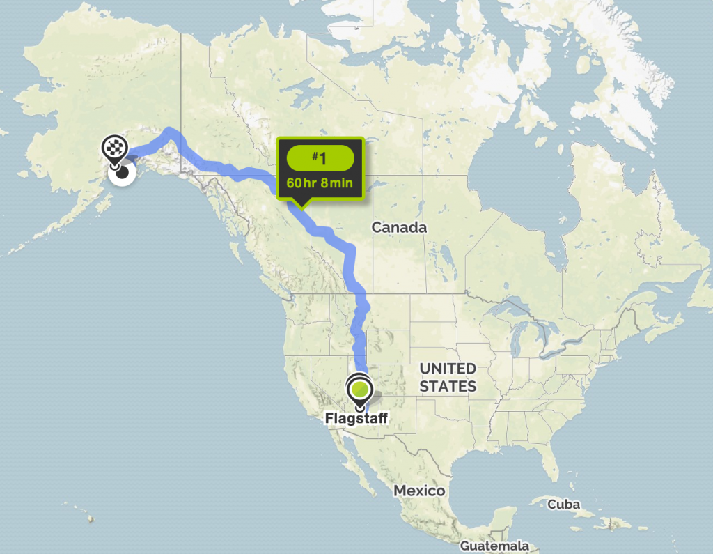
The only thing we knew for certain is that we were leaving from Flagstaff, Arizona and planned to leave the 2nd week of April, 2017 based on when we needed to be out of the RV park we’d spent the winter in.
There were a lot of good things about going the direct route, including being able to see more National Parks in Canada, but the weather going through mountains in Idaho and Montana left us feeling a little skittish. The other factor is that we weren’t sure where we would be headed after Alaska, but there was a pretty good chance we could hit those National Parks we missed on the way up, on our way out if we were going to go to the Beet Harvest or to Amazon. This helped to rule out this route completely, as we wanted to see as much as possible rather than go up and back down the same way.

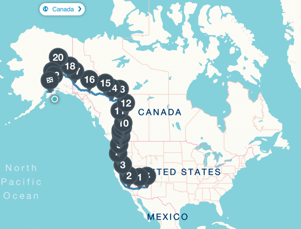
Our actual travel route, with all of our planned stops marked! Screenshot taken from Roadtrippers.com
In the end, we decided to go West out of AZ and then head North. The main reason was that we could see more friends this way, as well as spend a little bit of time in Oregon, which we had previously never made it to in the RV. The actual travel time ended up being very similar which meant that the gas costs would also be similar.
We knew that driving separately while traveling with a newborn was going to mean we needed to keep our plans more flexible than usual and that we’d probably have to travel shorter distances and spend more days on the road. To map things out in more detail than we usually do, I used a combination of Mapquest, Google Maps, and Roadtrippers . I then entered the entire trip into Roadtrippers where I was able to digitally make notes about each stop.
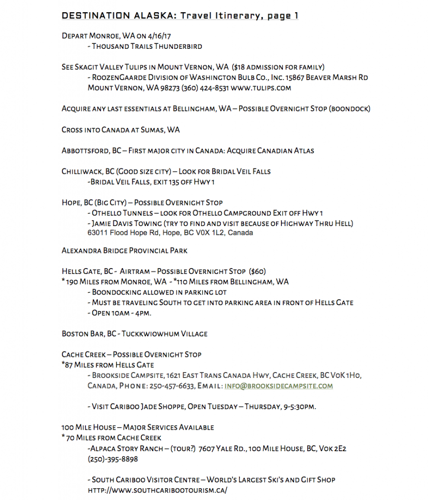
I ended up also making a printed itinerary. The itinerary was fairly detailed and included mileage, fun things to do along the route, places to stay and the cost etc. I noted which cities in Canada were bigger in case we needed groceries, gas, wifi etc. Had we not both been driving, and heading up pretty early in the visitor season, I am not sure that I would have been so detailed in my planning. We had the Milepost with us but it was incredibly hard to reference it while driving and we risked a screaming baby if we pulled over. The itinerary became even more invaluable during the many sections of road with absolutely no cell phone service since I had noted the address and phone numbers of places we planned as options to stay at or visit.
It was just a rough plan and we detoured from it quite a bit, but this way we could leave our plans with my Dad and he could follow along. We called each day and updated him as things changed so he would still have an idea where we were. This also helped with our emergency plan in case something went wrong and we had no cell phone service – he would know where we had planned to be and it would give an idea where to send help.
Once the route was ironed out it was time to start the physical preparations for the trip…


 Alaska or Bust !
I love hearing from my readers - thanks for leaving a comment!